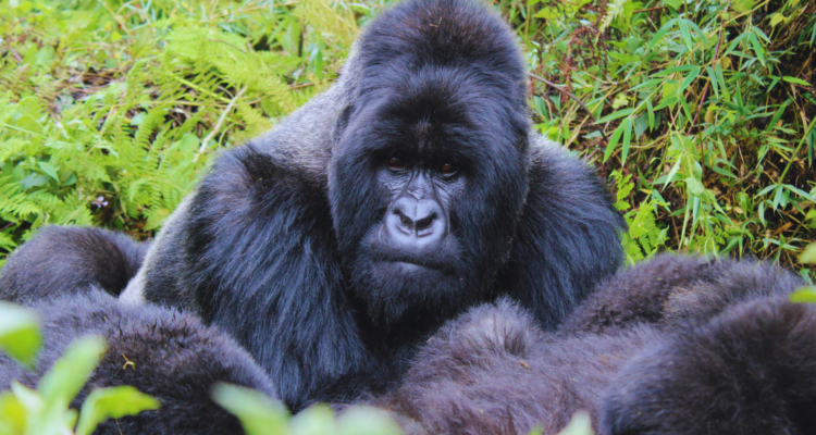
Gorilla trekking Uganda offers a rugged, raw experience that contrasts sharply with the manicured volcanic slopes of Rwanda. You’ve likely seen the soul-stirring photos of Silverbacks in the mist, but the topography behind those images dictates whether your journey is a pleasant stroll or a grueling test of endurance. Choosing between Bwindi Impenetrable Forest and Volcanoes National Park isn’t just a matter of permit price; it’s a matter of mapping your physical capabilities against two very different prehistoric landscapes.
If you are planning uganda gorilla trekking tours, you are essentially choosing between the “up-and-down” ridges of an ancient rainforest and the steady, high-altitude climb of dormant volcanoes. Miscalculating the incline grade or the vegetation density can be the difference between a triumphant encounter and a mid-trek physical collapse.
The Topographical Split: Volcanic Slopes vs. Ancient Ridges
The fundamental difference in terrain mapping between these two regions lies in their geological origins.
Rwanda: The Volcanic Incline
Volcanoes National Park is defined by five dormant peaks. The terrain is largely characterized by open bamboo forests and Afro-alpine moorlands.
- The Incline: It is a linear, constant ascent. You start at the base and climb up the side of the volcano.
- The Footing: Volcanic soil is porous but can become slick “black cotton” mud during the rains.
- The Altitude: This is the silent killer. Rwanda’s trailheads often start where Uganda’s treks end.
Uganda: The “Impenetrable” Undulations
Bwindi is an ancient, non-volcanic mountain range. It is a series of deep valleys and steep, sharp ridges.
- The Incline: It is never a straight climb. You will descend into a valley, cross a stream, and then climb a 45-degree ridge, only to repeat the process.
- The Footing: Tangled root systems and dense “Lianas” (woody vines) create a natural obstacle course.
- The Humidity: The canopy is much denser than Rwanda’s, trapping moisture and making the trek feel more physically taxing even at lower altitudes.
Elevation Mapping: Susa Group (Rwanda) vs. Mubare Group (Uganda)
To understand the “Information Gain” of terrain mapping, look at the two most iconic groups in each country.
The Susa Group (Rwanda)
Located on the slopes of Mt. Karisimbi, the Susa group is the most physically demanding trek in Rwanda.
- Base Elevation: ~2,500m (8,200 ft).
- Peak Trekking Altitude: Often reaches 3,100m – 3,500m (11,500 ft).
- Terrain Profile: You are fighting the thinning air. The vegetation is sparse at this height, meaning you are exposed to the elements, but the sightlines for photography are unparalleled.
The Mubare Group (Uganda)
As the first habituated group in gorilla trekking uganda history, based in the Buhoma sector, the Mubare group offers a different challenge.
- Base Elevation: ~1,450m (4,750 ft).
- Peak Trekking Altitude: Usually caps at 1,800m – 2,100m (6,900 ft).
- Terrain Profile: While the altitude is lower, the “treadmill” effect of the steep ridges is relentless. You aren’t fighting oxygen deprivation; you are fighting the “Impenetrable” forest floor.
Data Organization: Terrain Comparison at a Glance
| Feature | Volcanoes NP (Rwanda) | Bwindi Impenetrable (Uganda) |
| Vegetation Density | Low to Moderate (Bamboo zones) | Very High (Dense Rainforest) |
| Average Incline Grade | 15% – 25% (Steady) | 30% – 45% (Sharp/Undulating) |
| Altitude Range | 2,400m , 3,800m | 1,160m , 2,600m |
| Sightlines | Clearer (Better for wide shots) | Tight (Challenging for photography) |
| Trek Duration | 2 , 5 Hours (Usually) | 3 , 8 Hours (Unpredictable) |
Sightlines and Photography: The Hidden Terrain Factor
Terrain mapping isn’t just about your legs; it’s about your lens.
In Rwanda, the bamboo forest acts as a natural “filter.” The light is softer, and because the undergrowth is less chaotic, you can often capture the entire gorilla family in a single frame.
In Uganda, the “Impenetrable” name is literal. You are often shooting through a “window” of leaves. This creates an incredibly atmospheric, National Geographic-style aesthetic, but it requires a master copywriter’s level of patience and a fast lens (f/2.8 or better) to handle the low-light canopy.
Choosing Your Optimal Trekking Location
- Choose Rwanda if: You struggle with technical footing but can handle high altitudes. You prefer shorter, sharper bursts of activity and world-class luxury lodges under 20 minutes from the trailhead.
- Choose Uganda if: You have strong knees for steep descents and prefer a longer, more authentic “jungle” expedition. Uganda gorilla trekking tours are the choice for those who want the journey to be as much of a story as the destination.
Frequently Asked Questions
Which is harder: Bwindi or Volcanoes NP?
Bwindi is technically harder due to the dense undergrowth and “up-and-down” ridges. However, Rwanda is more aerobically challenging because of the significantly higher altitude.
Can I choose a “short” trek?
In both countries, you can request a “close” group at the morning briefing. However, gorillas are wild; a family that was 30 minutes away at 7:00 AM can move two ridges over by 9:00 AM. Never assume a “short” trek.
What should I wear for Bwindi’s terrain?
Long trousers, long-sleeved shirts, and gaiters are non-negotiable. The “impenetrable” forest is full of stinging nettles and “wait-a-bit” thorns that will shred standard gym gear.
Is the altitude in Rwanda dangerous?
For most, it causes slight breathlessness. However, we always recommend spending at least one night in Kigali or Musanze to acclimatize before attempting the Susa or Karisimbi groups.
Don’t leave your trek to chance. Whether you seek the volcanic heights of Rwanda or the ancient ridges of Uganda, our team specializes in matching your fitness profile to the perfect gorilla family.
 >
>